[Maximum number: 6]
Remote sensing satellites are used to monitor the Earth's ecosystems. One measure of ecosystem status is leaf area index (LAI), which is the total area of leaves in square metres per square metre ( ) of the Earth's surface. The graph shows LAI estimates, calculated using data from the Global Inventory Monitoring and Modelling System (GIMMS), during the period from 1981 to 2011. The data points are monthly averages in four latitudinal zones in the northern hemisphere.
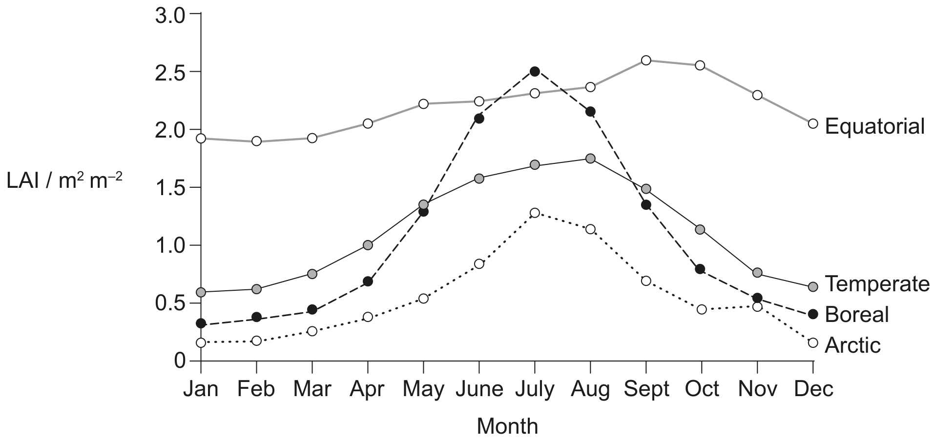
(a)
Compare and contrast the LAI data for the arctic and temperate zones.
[ 2 ]
(b)
Suggest reasons for the differences in LAI between the boreal and equatorial zones.
[ 3 ]
(c)
The data in the graph show a long-term trend in global LAI.
[ 1 ]
(i)
State the trend.
[ 1 ]