[Maximum number: 1]
List two biomes found in Brazil.
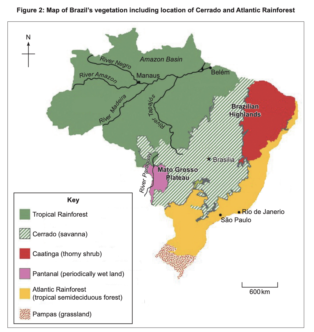
Figure 2: Brazil vegetation map, including Cerrado and Atlantic Rainforest
 EduNinja
List two biomes found in Brazil.
Figure 2: Brazil vegetation map, including Cerrado and Atlantic Rainforest
Figure 2(a): Fact file and climate graph for Hokkaido/Sapporo
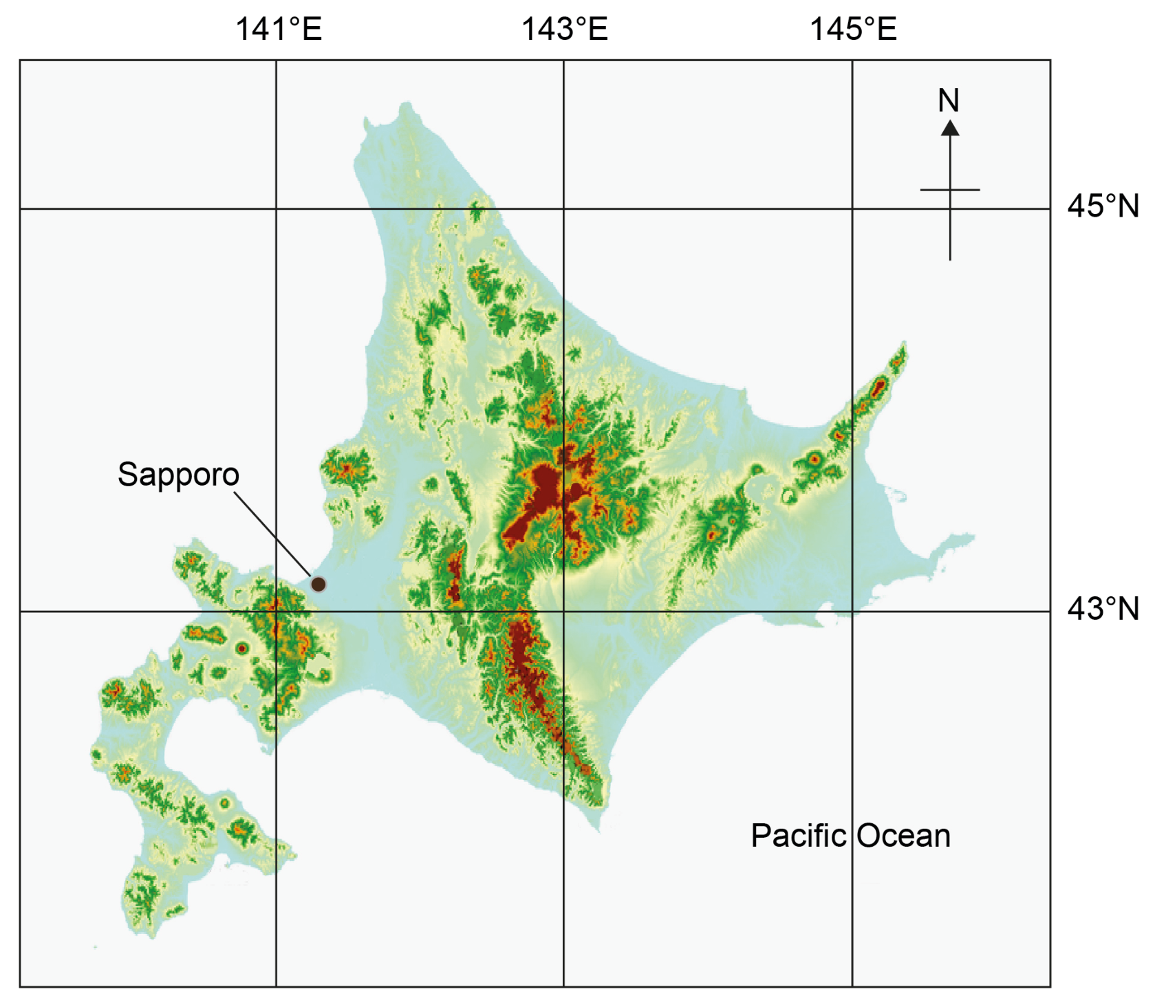
Figure 2(c): Elevation map of Hokkaido
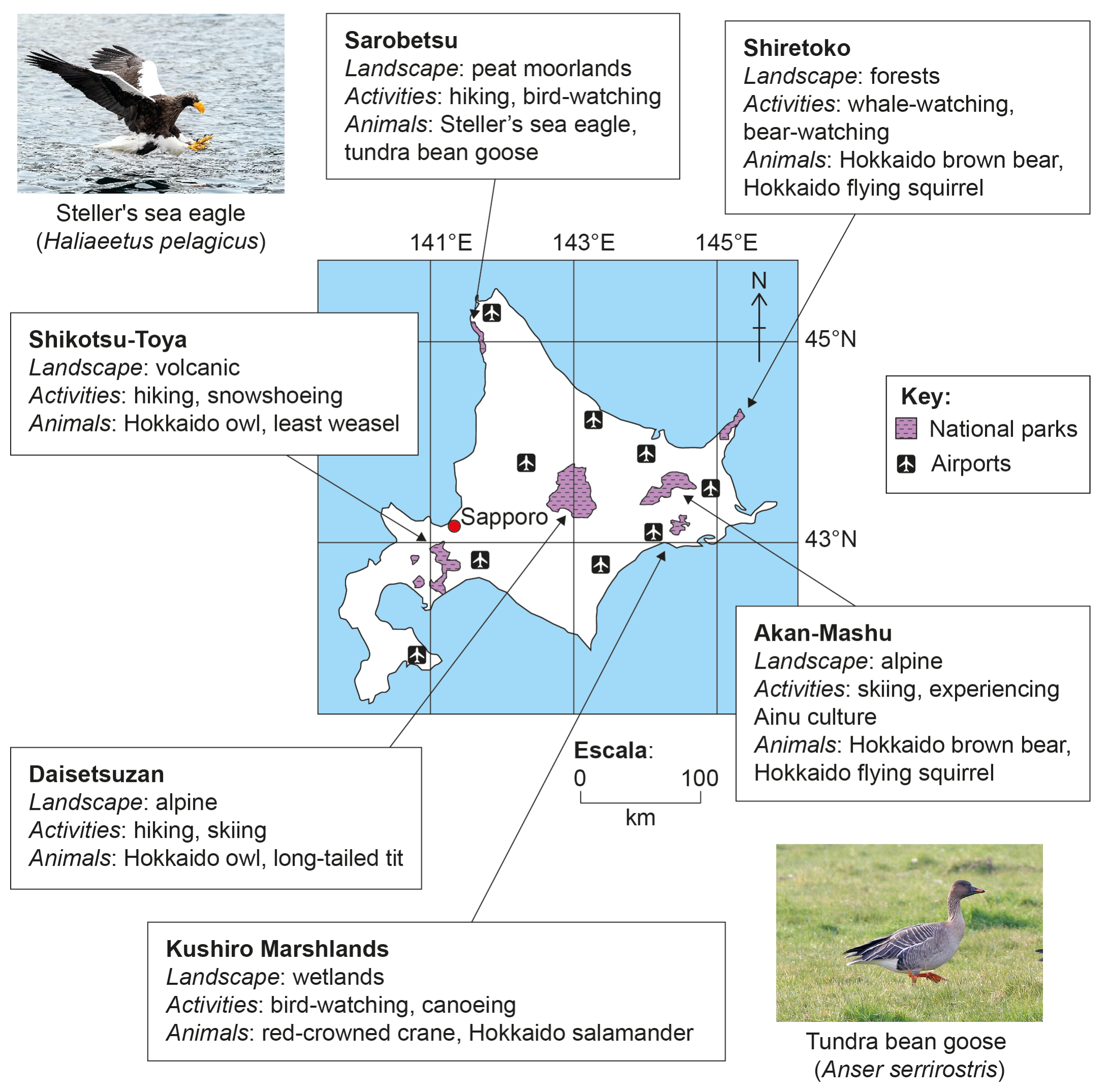
Figure 3(b): Hokkaido's national parks and airports
Using Figure 2(b), state the annual temperature range for Sapporo.
Using Figures 1(a), 2(b) and 2(c), identify one terrestrial biome found on Hokkaido.
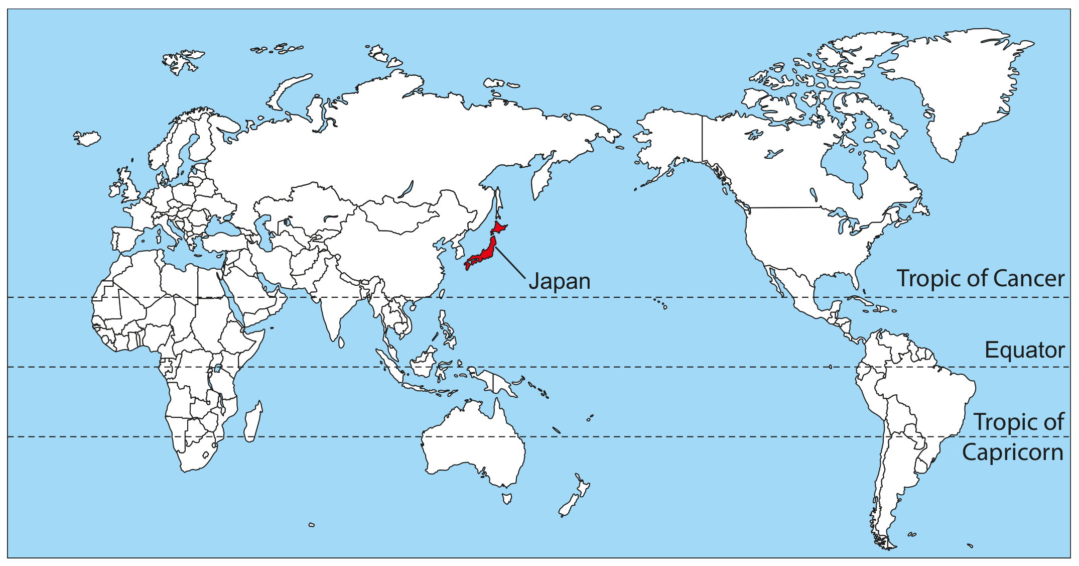
Figure 1(a): World map showing location of Japan
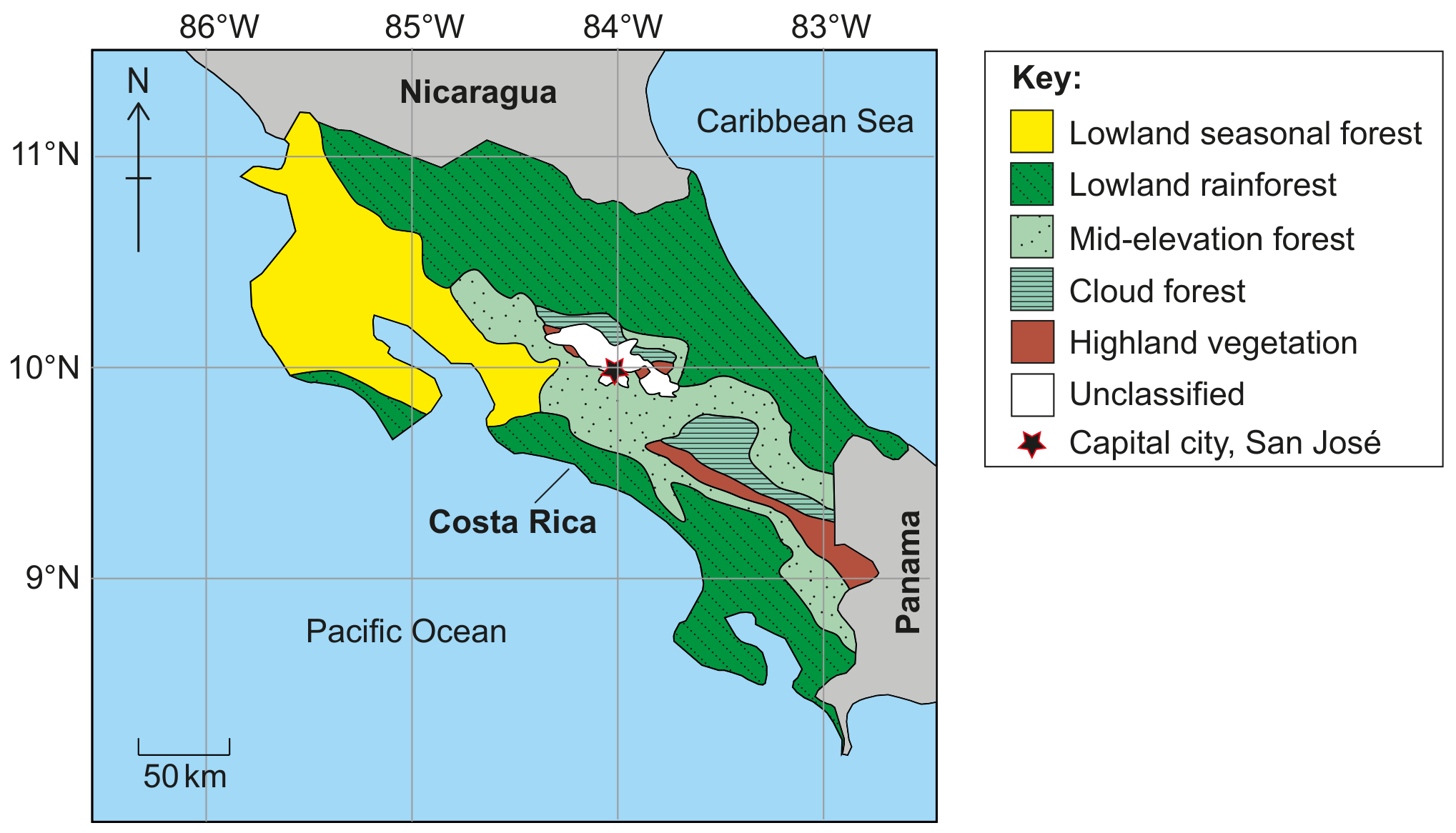
Figure 3(a): Main vegetation zones in Costa Rica
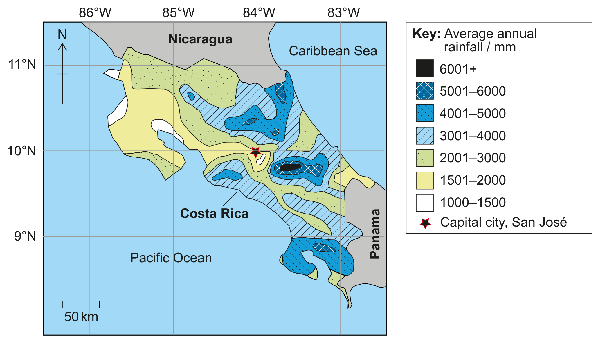
Figure 3(c): Average annual rainfall in Costa Rica
With reference to Figures 3(a), 3(b) and 3(c), identify the climatic conditions in lowland seasonal forest.
With reference to Figure 2(a), identify the most widespread biome in Siberia.
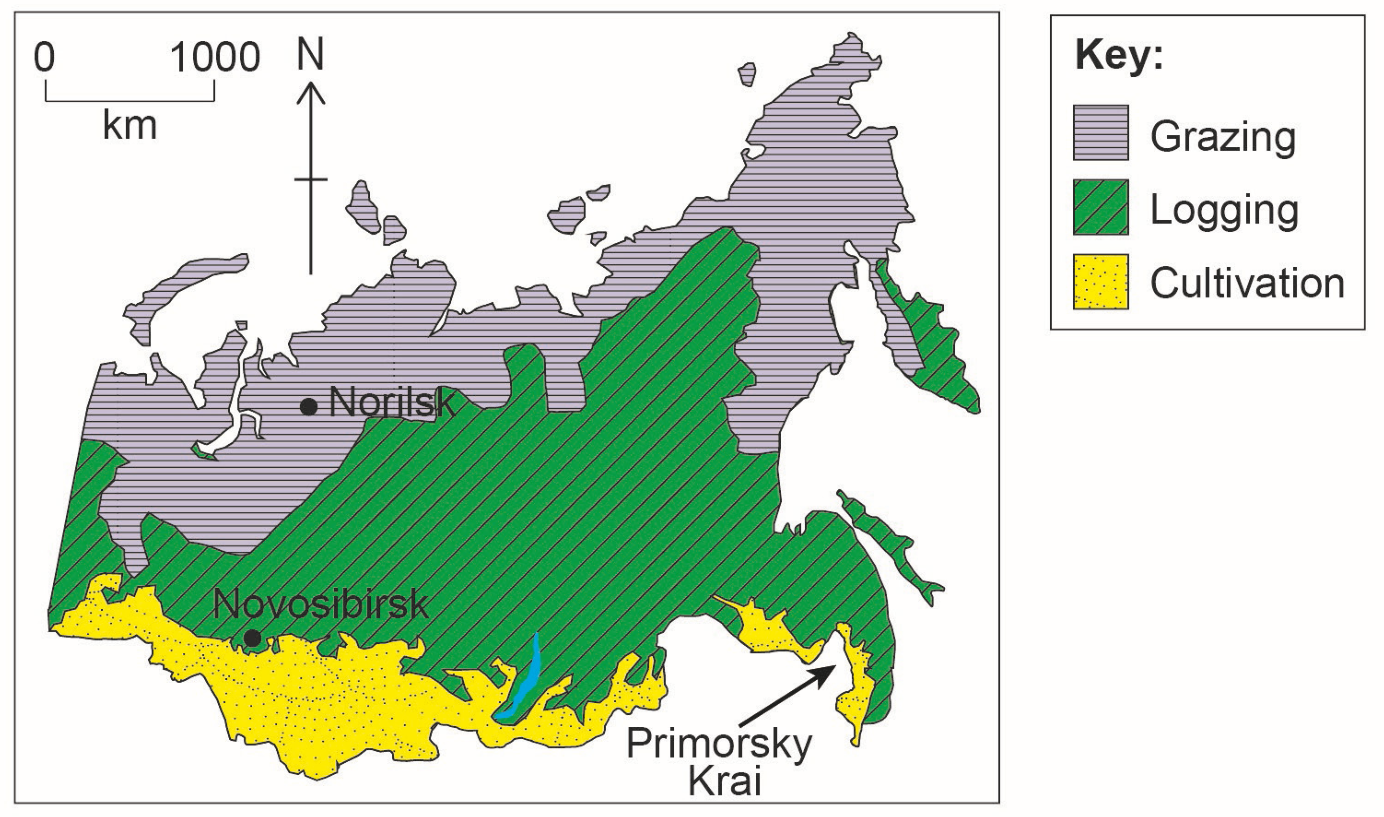
Figure 2(c): Dominant agricultural activities in Siberia, Russia
Using Figures 2(a) and 2(c), identify the agricultural activity that covers the greatest area in the taiga.
With reference to Figures 1(b) and 1(c), identify the biome found at the highest altitude in Madagascar.
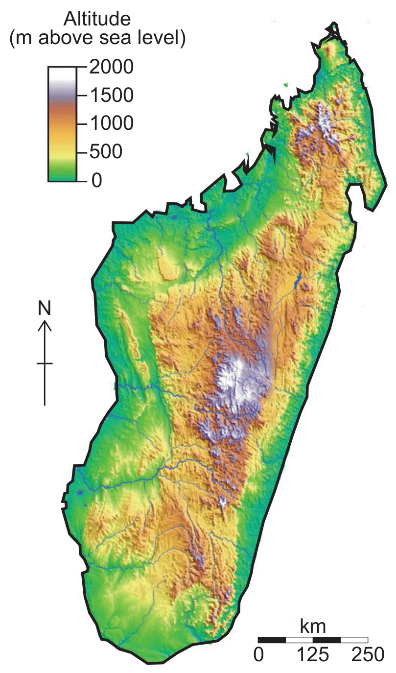
Figure 1(b): Topographic map of Madagascar
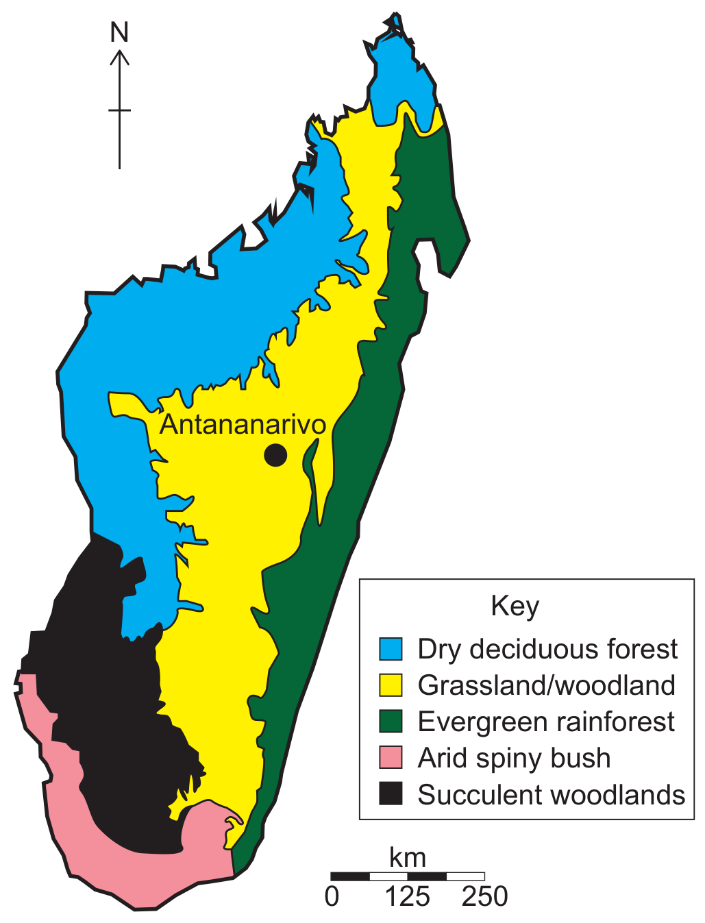
Figure 1(c): Biomes within Madagascar
State one biome found in Iceland.
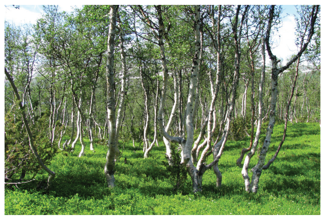
Figure 5: Native birch trees in Iceland
With reference to Figure 3, identify the type of biome found in Iraq.
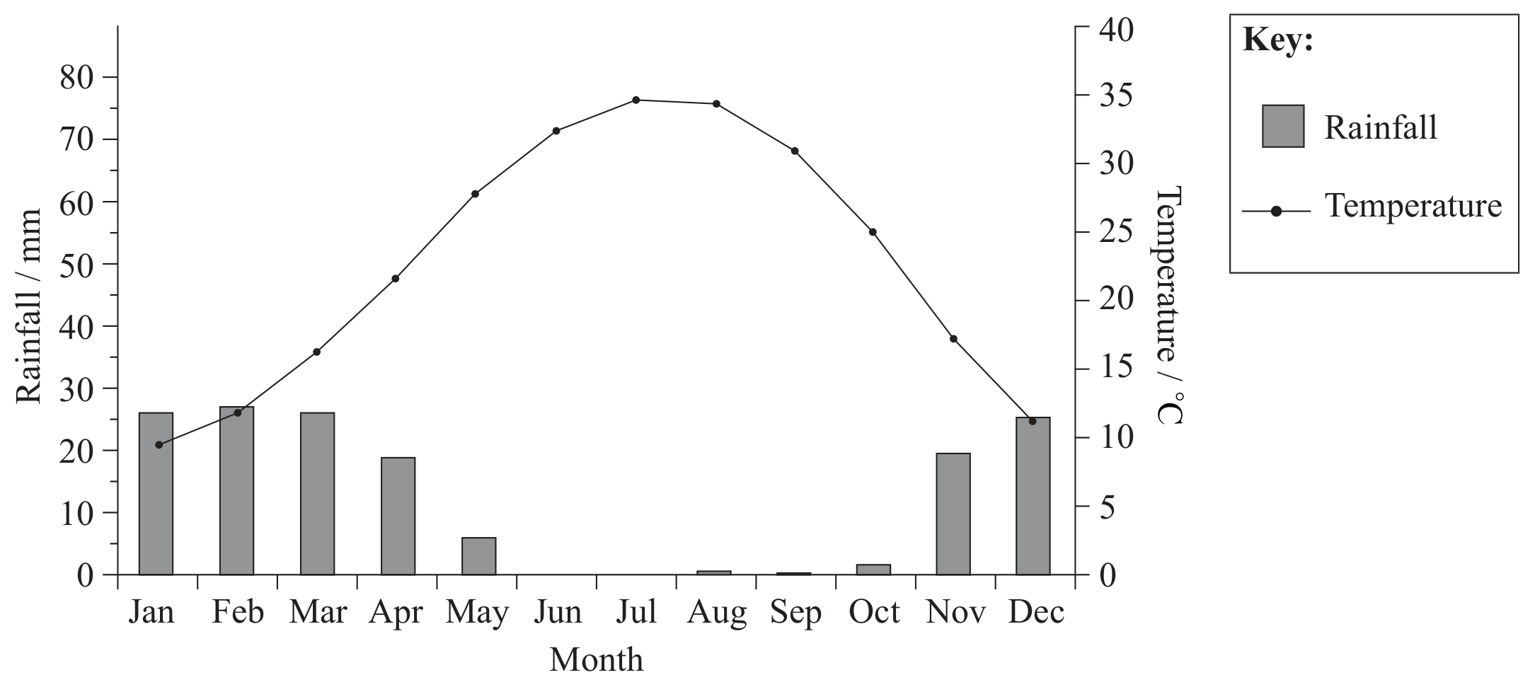
Figure 3: Climate graph of Baghdad, Iraq
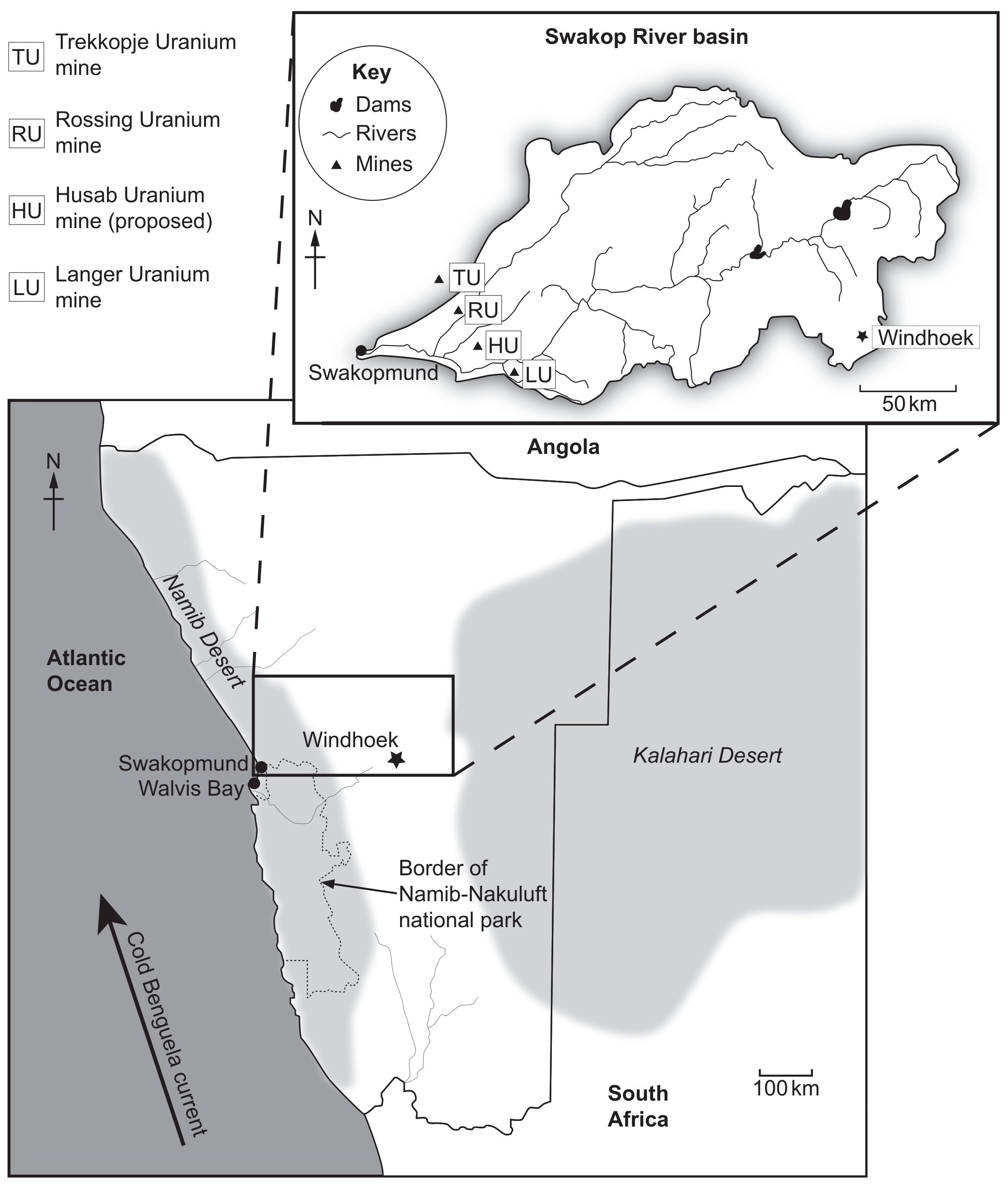
Figure 1(b): Map showing Swakop River in Namibia
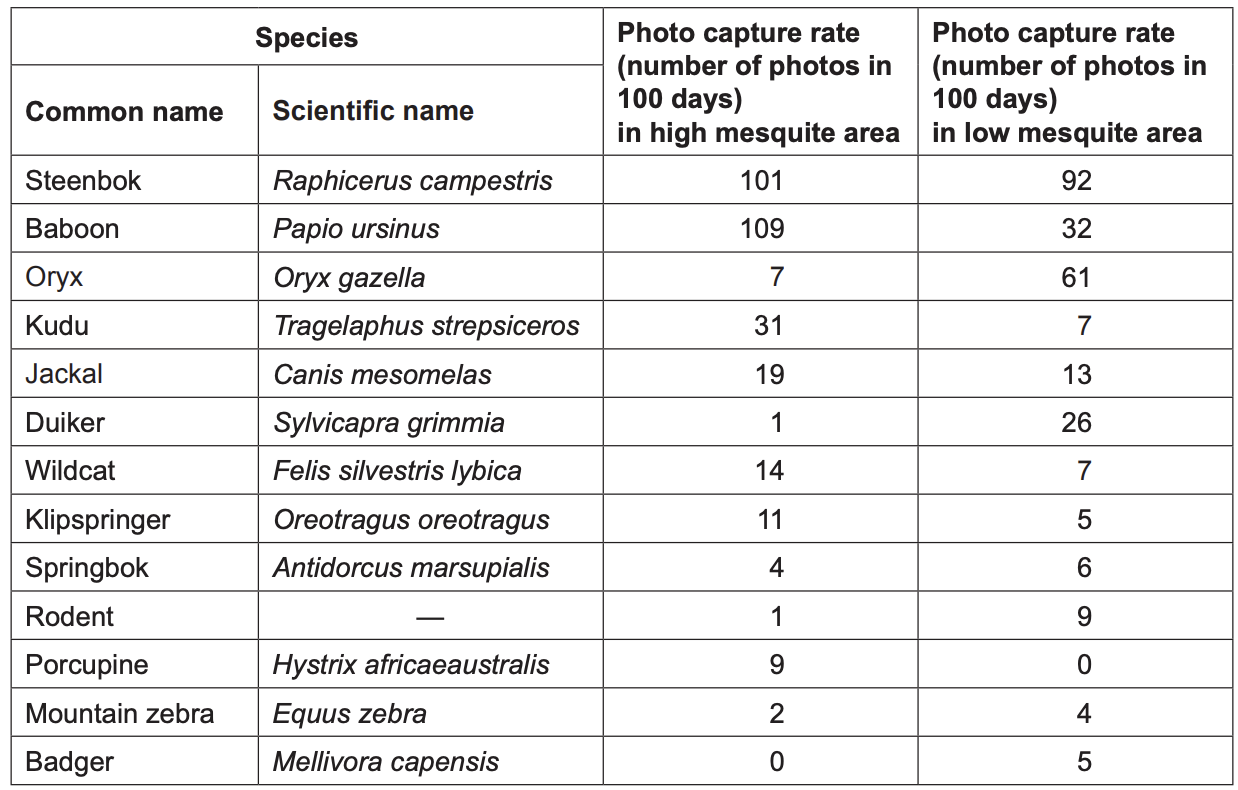
Figure 4(b): Camera trap data for high and low mesquite areas
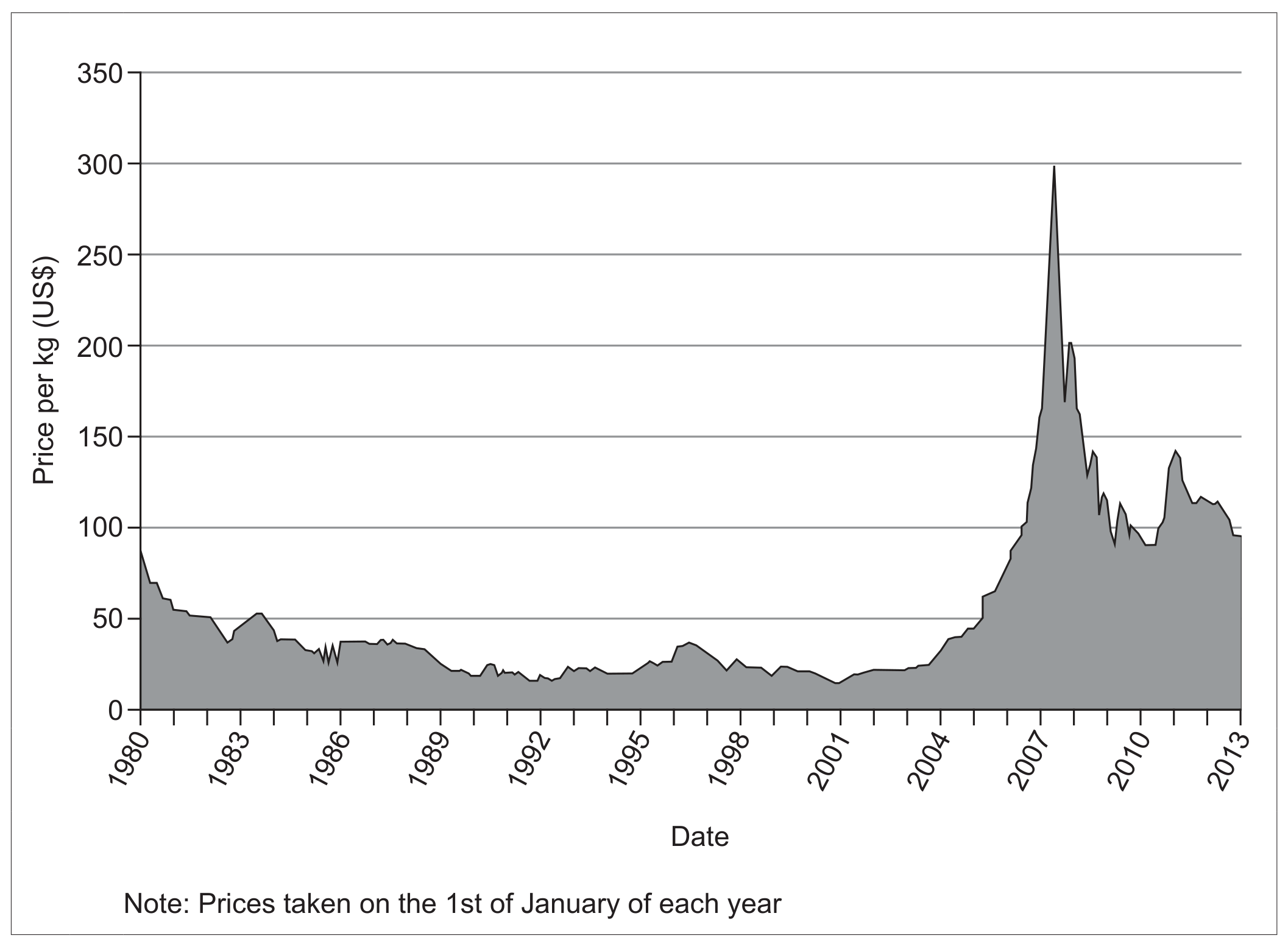
Figure 5(a): Uranium prices from 1980 to 2013
State the biome for the area shown in Figure 1(b).
With reference to Figure 7, state the most common ecosystem in Zambia.
| Biome | Ecosystem | km^2 | \% |
|---|---|---|---|
| Forest | Dry evergreen | 15835 | 2.10 |
| Forest | Deciduous | 6735 | 0.90 |
| Forest | Thicket | 1900 | 0.25 |
| Woodland | Miombo | 294480 | 39.13 |
| Woodland | Kalahari sand | 84260 | 11.20 |
| Woodland | Mopane | 37010 | 4.92 |
Figure 7: Coverage of ecosystems in Zambia
Figure 7 lists biomes and ecosystems in two different columns. Distinguish between a biome and an ecosystem.
| Biome | Ecosystem | km^2 | \% |
|---|---|---|---|
| Forest | Dry evergreen | 15835 | 2.10 |
| Forest | Deciduous | 6735 | 0.90 |
| Forest | Thicket | 1900 | 0.25 |
| Woodland | Miombo | 294480 | 39.13 |
| Woodland | Kalahari sand | 84260 | 11.20 |
| Woodland | Mopane | 37010 | 4.92 |
Figure 7: Coverage of ecosystems in Zambia
Figure 1 below shows a food web for an ecosystem within a Tundra biome.
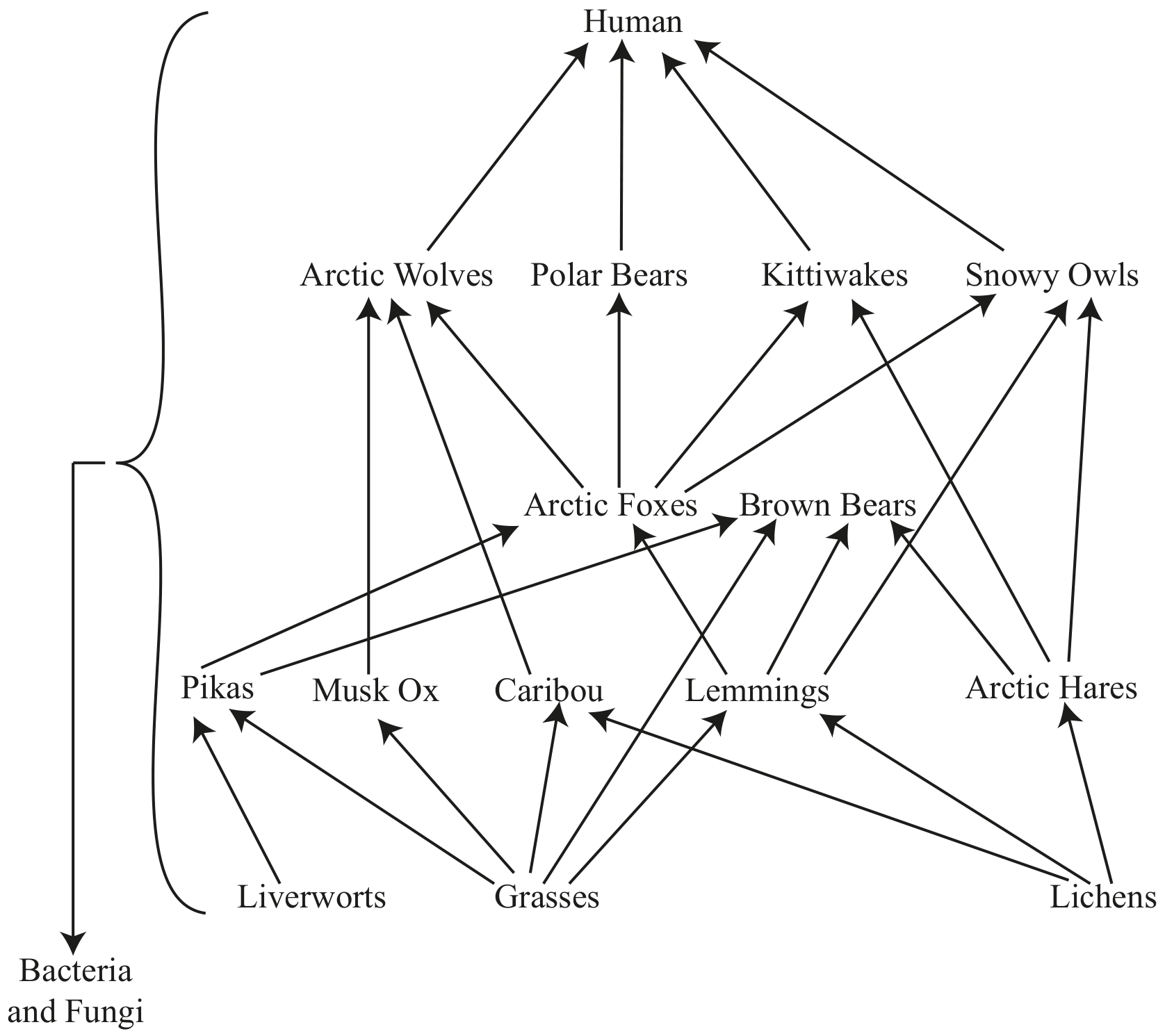
Figure 1
Define the term biome.
Identify two abiotic factors that affect the distribution of tundra.