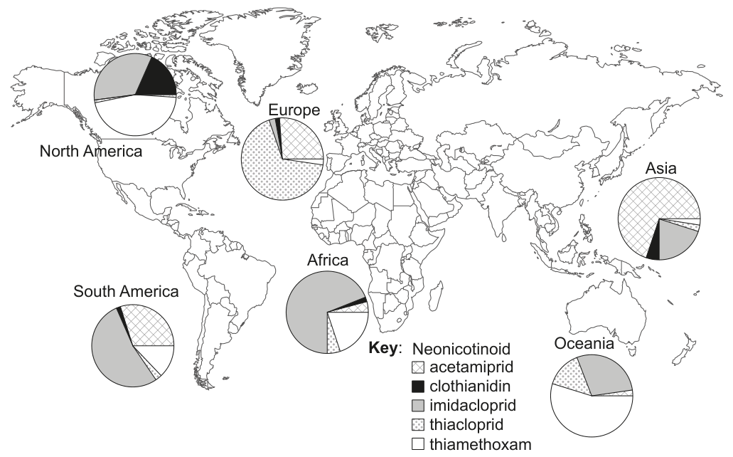
[Maximum number: 13]
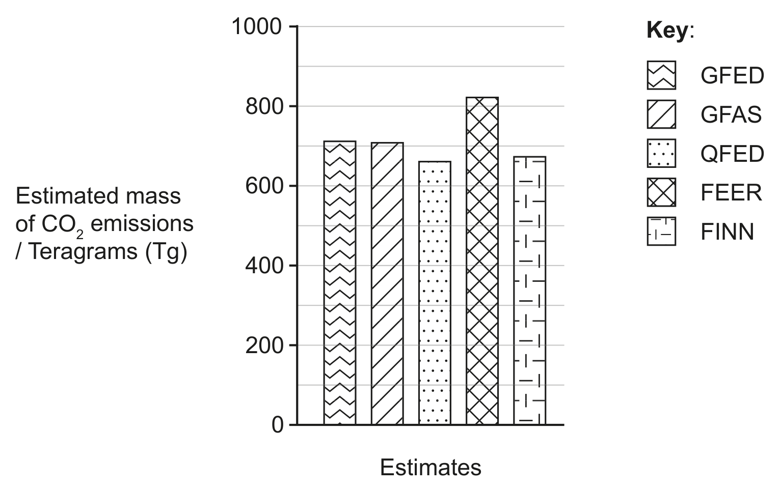
There were widespread and intense wildfires in Southeast Australia during the summer season from November 2019 to January 2020. Estimates have been made of carbon dioxide emissions from these fires based on satellite monitoring data. The bar chart shows estimates made by five different research programmes: GFED, GFAS, QFED, FEER and FINN.
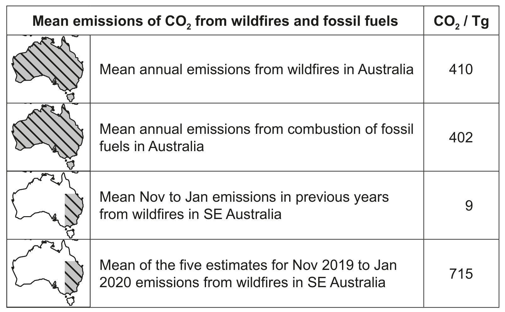
The table shows other statistics for comparison.
2019-2020 constrained by satellite. Nature (597), pp. 366-369. https://doi.org/10.1038/s41586-021-03712-y.]