EduNinja
Question rangeB4.1.6—Terrestrial biome distribution
[Maximum number: 15]

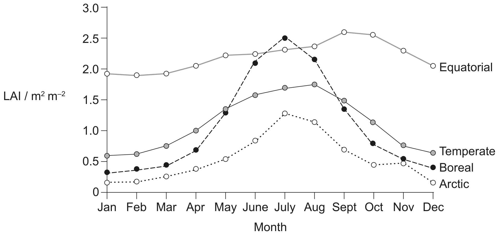
Remote sensing satellites are used to monitor the Earth's ecosystems. One measure of ecosystem status is leaf area index (LAI), which is the total area of leaves in square metres per square metre ( m2 m2\mathrm{m}^{2} \mathrm{~m}^{-2} ) of the Earth's surface. The graph shows LAI estimates, calculated using data from the Global Inventory Monitoring and Modelling System (GIMMS), during the period from 1981 to 2011. The data points are monthly averages in four latitudinal zones in the northern hemisphere.

Question image
[Maximum number: 1]

A graph of abiotic factors needed for biomes to develop is shown. Which label identifies temperate forest?

Question image

Primary plant succession has been observed in sand dunes adjacent to the northern end of Lake Michigan, one of the Great Lakes in North America. The youngest sand dunes have beach grass (Ammophila breviligulata) and prairie bunch grass (Schizachyrium scoparium). The oldest dunes have coniferous trees (Pinus strobus and Pinus resinosa).

The climograph shows the distribution of biomes according to the temperature and rainfall of land areas on Earth.

Mean annual temperature 1C1{ }^{\circ} \mathrm{C}

Question image
[Maximum number: 3]

Each biome has unique characteristics in terms of organisms, weather, nutrient flow and stores.

The graph shows the variation in the annual temperature and precipitation in different ecosystems.

[Maximum number: 5]

(a) The climograph shows data collected at Mangalore, India. The natural vegetation of the surrounding area is forest and the climate is tropical.

Question image
0